Creating Georeferenced Plates for ForeFlight
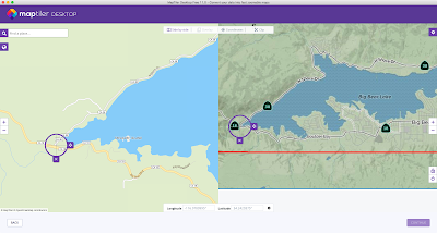
File this under something I didn’t even know it could do ... Big Bear Municipal Airport has multiple noise abatement arrival and departure routes the city would prefer you fly. I’ll be honest, with seemingly every local airport having its own noise abatement idiosyncrasies, it’s hard for me to remember all of them. So I created georeferenced overlays in ForeFlight so I don’t have to.
First, I downloaded the map the city provided, and the routes (which are alpha channel PNGs that overlay the base map), using the web developer tools built into the Safari web browser:
I then used GIMP to merge the routes onto the provided map and export a unified PNG file:
I exported the result as an .mbfiles document, which I copied to Dropbox and, from within the Dropbox app on my iPhone, selected, exported, and opened in ForeFlight.
ForeFlight (at least as of 12.11.1 (64301) makes these available under the More button (bottom right corner) → Custom Content → Custom Charts, and then under whatever name you've given it. The end result will look a little like the screenshot below. (I’m using the free version of MapTiler, which watermarks the resulting render and appears to lower the resolution significantly - and the original wasn’t exactly high res. I may pay for this software (at least the $29 version) so I can make versions of these that can be circulated...)
There’s also evidently a way to build something like this in Google Earth and bring it into ForeFlight as a KML file, but I haven’t explored that option yet. Nor have I repeated this process for all of the arrival and departure plates - but I will. MapTiler loads the previous georeferencing coordinates, saving that tedious step.
I only prepared the arrivals and departures to the west, as that’s what I’ll be flying, but if/when I buy the software and prep these “for real,” I’ll do ’em all. Here’s the results of my initial effort:
More reading:
MapTiler georeferencing generally, and assigning locations visually specifically.


Comments
Post a Comment